Description
What is MESSIR-SAT?
MESSIR-SAT is a system (hardware + software) able to acquire, process, store and display satellite imagery.
MESSIR-SAT can process METEOSAT, as well as MTSAT, GOES, INSAT satellites images.
MESSIR-SAT can be delivered as a standalone “all-in-one” workstation able to perform all functions of acquisition, processing and display.
MESSIR-SAT can also be delivered as a pre-processing MESSIR-SAT server, acquiring and dispatching the satellite data to MESSIR-SAT Workstations and/or MESSIR-VISION Forecaster Workstations.
MESSIR-SAT Main Functions
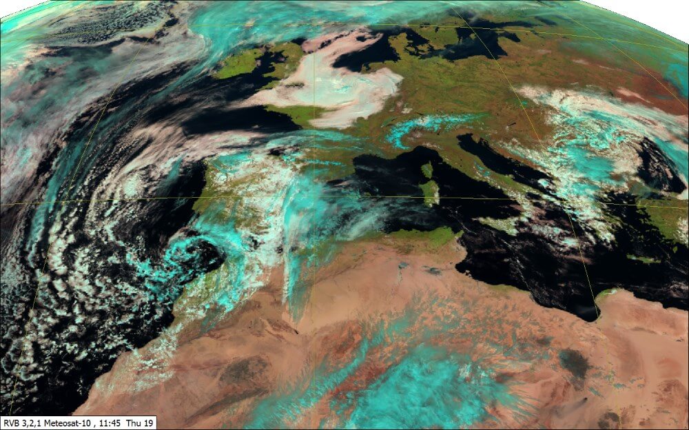
MESSIR-SAT offers a complete set of functions to take full advantage of the volume of satellite imagery now available:
- Imagery acquisition, either from a parabolic antenna or from a FTP server
- Acquisition of other data flow, as “MDD”
- Storage in database
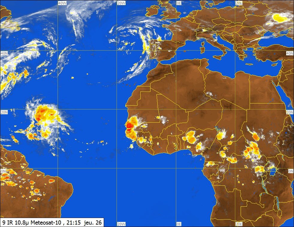
- Display and animation of satellite imagery, integration with other data types
- Production of images for end-users
- Dissemination to Web servers, other workstations, servers….
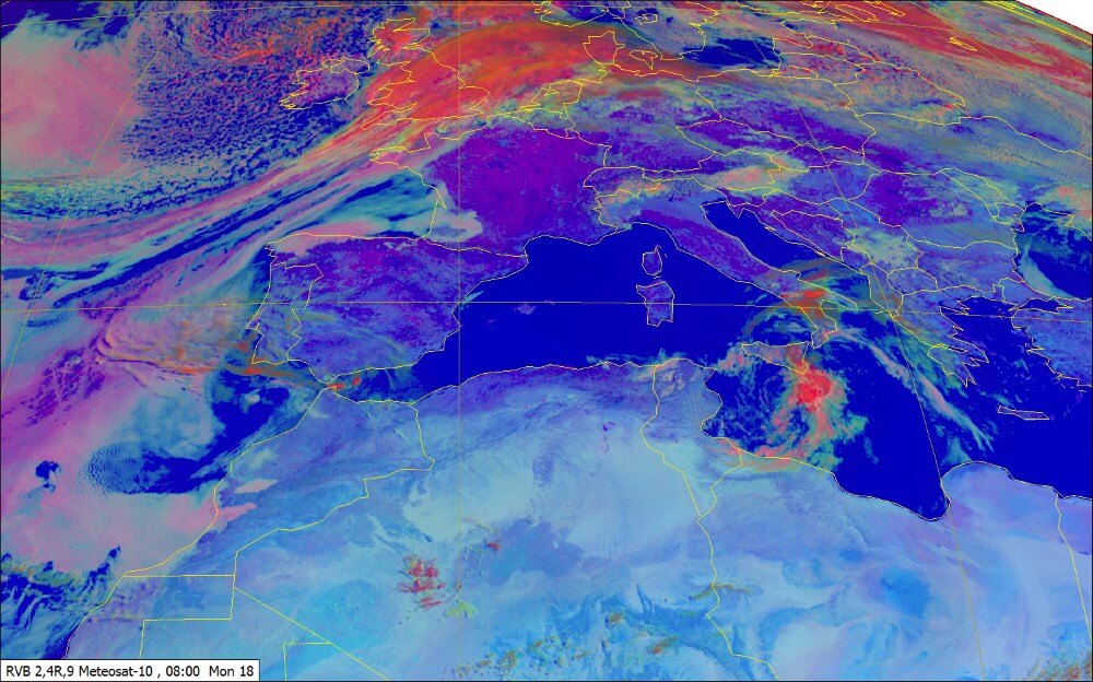
Fig.1 – RGB 2,4R,9 – Day Microphysic, Summer
MESSIR-SAT Key Features
- C-band or Ku-based reception of XRIT (HRIT+LRIT) data flow
- Compliant with the EUMETCast service (EUMETSAT EUM TD 15 compliant)
- Access to the full range of METEOSAT data and products
- 12 SEVIRI spectral channels from METEOSAT satellites available
- 3 visible channels: VIS06, VIS08, HRV (High Resolution Visible) 1km resolution
- 7 infrared channels: IR 1.6, IR 3.9, IR 8.7, IR 10.8, IR 12.0, IR 9.7, IR 13.4
- 2 water vapour channels: WV 6.2,WV 7.3
- Satellite image animation
- Geostationary and polar orbiting satellite images: Meteosat-7, GOES-E, GOES-W, MTSAT , METOP, INSAT, AVHRR
- Atmospheric Motion Vectors (AMV), Multi-Sensor Sensor Precipitation estimate (MPE)
- Cloud Analysis and classification, Sea Surface Temperature (SST)
- Cloud Top Height (CTH), Normalized Difference Vegetation Index (NDVI)
- SAF products: land surface analysis, products for nowcasting and short range forecasting, climate products, products for hydrology and water management
- Albedo, Meteorological Products Extraction Facility (MPEF)
- Rapid Scanning Service (RSS) for images up to 5 minutes frequency
- ATOVS / EARS data processing
- GRIB-coded Numerical Weather Prediction Model (ECMWF, EGRR models…)
- MDD text and graphical products in WMO format (SYNOP observations…)
- Vertical soundings (TEMP)
- PNG/T4 chart display
- Quick-view of the latest images received
- Channels calibration made from EUMETSAT. VIS channels are calibrated in reflectance and IR/WV channels in temperature
- Spectral channels combination: differences, RGB composites…
- Integrated map editor featuring:
- Standard re-projections: space view, cylindrical, Mercator, Lambert, stereographic
- User-defined geographical areas, selectable map components: boundaries, coasts, rivers, regions, Flight information regions (FIR), airports, cities …
- Digital elevation data
- Satellite images overlay with other METEOSAT geo-referenced data: surface/upper-air observation, NWP model outputs…
- Calibration and customizable colour palettes: RGB values, transparency… …
- 3D product generation
- Multi-screen support (with compatible video card)
- Image annotation facility including library of standard meteorological symbols and features (fronts, clouds, phenomenon…)
- Various image formats: JPEG, PNG, TIFF, GIF, PDF…
- Events and operations logging journal
- Manual or scheduled-basis image export, Web server feeding


